double click image to open in new window
creator:Erskine, Robert, 1735-1780.
title:
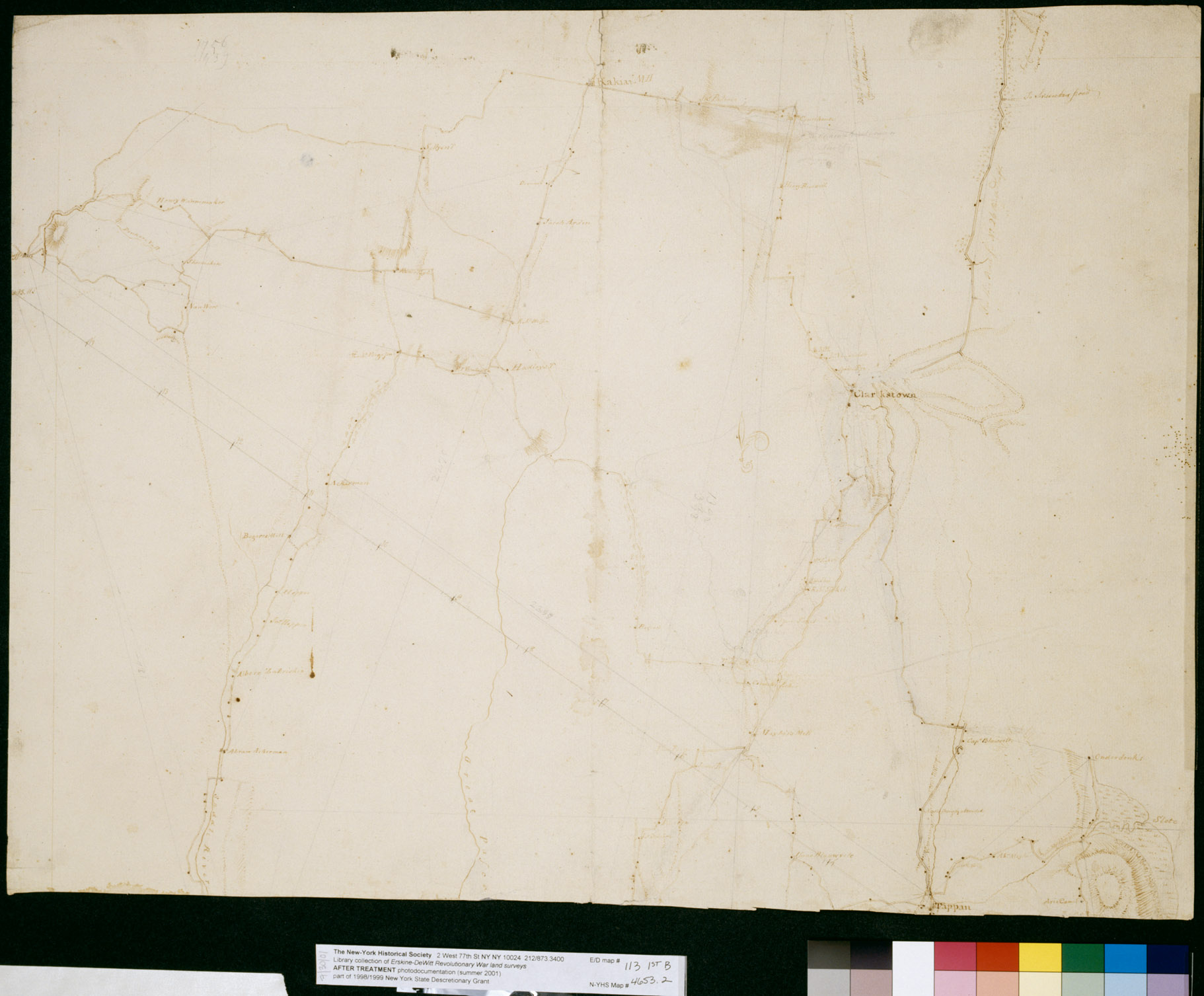
Roads between Suffrans, Tappan, Kakeate Peramus, Dobbs Ferry, Clarkstown +c. No 113, 1st / by Robert Erskine F.R.S. Geogr. A. U.S. and Assistants.
genre/form:Early works to 1800 -- lcsh
format:
99.0 cm. wide by 66.0 cm.high, 1 map
description:
Military topographic map. Covers the townships of Orangetown, Ramapo and Clarkstown in Rockland County, New York, and of Herrington, Washington, Palisades, Midland, Ridgewood and Orvil in Bergen County, New Jersey. Shows buildings and owners' names, landforms and streams. Shows relief by hachures. Title proper from recto is the work of a later editor--Simeon DeWitt or his assign--subsequent to 1820. Title from verso is in Erskine's hand and may be cited as such. Index title, statement of responsibility, date, series title and series numbering also by Erskine, but on separate index sheet filed at head of series. Pen-and-ink, pencil on laid paper. Watermark: "Pz" Foxed, stained, creased and abraded. Mounted on cloth, bound and cropped, disbound and silked by subsequent owners. Cut in half. Cleaned after removal of backings 1999; some fill remains. Sheathed in mylar. In erased pencil on recto: "No 113 1st"
identifier:
004653.2_004653.1
provenance:
New-York Historical Society
 Witness to the Early American Experience